テーブルマウンテン / Table Mountain


SHARE REVIEWS FROM GOOGLE MAP VOL.1
Breakfast Rock
(TRANSLATED BY GOOGLE)
絶妙な景色を楽しみながらあなたが食べるために使用することができ、広い、平らな岩。岩の上に取得するにはボルダリングのビットがあります。あなたはテーブルマウンテンを登るたびにウインドブレーカーをパックすることを忘れないでください!
(ORIGINAL TEXT)
A wide, flat rock which you can use to eat on while enjoying the exquisite view. To get onto the rock there is a bit of bouldering. Remember to pack a windbreaker whenever you go up Table Mountain!
QUOTE SOURCE:Google マップ
Waterworks Museum
(TRANSLATED BY GOOGLE)
歴史の本当に素晴らしい作品。なお、ここでの旅行を取る価値があります。ピクニックバスケットを取ると博物館を見た後、ダム壁に沿って散歩をします。あなたのピクニックを持つことができますいくつかの非常に素晴らしい場所があります。今年の特定の時間に、あなたは、DISA(家族ラン科)を見つけることができます。美しい赤い花。それらはまた、青色(半不足)に見出されます。
(ORIGINAL TEXT)
A really great piece of history. It is worth taking a trip here. take a picnic basket and after viewing the museum take a walk along the dam wall. There are some very nice places where you can have your picnic. At certain times of the year you can find the Disa (family Orchidaceae). A beautiful red flower. they are also found in blue (semi-scarce).
QUOTE SOURCE:Google マップ
Joshua Penny's Cave
(TRANSLATED BY GOOGLE)
ジョシュア・ペニーに対する大きな敬意は、1799年にこの洞穴を見つけるだけでなく、14ヶ月間この場所を彼の家にしたことでした。私は二度そこに行ってきました。そこに着くのは深刻な登りですが、間違いはありません。これは、テーブルマウンテンで一番難しい場所の一つでなければなりません。経験豊富なガイドなしでそこに藩いて、あなたがハイキングに十分にフィットしていることを確認し、必要と思われるよりも多くの水を運ぶようにしないでください。訪問するのはすばらしい場所であり、自分自身に恩恵を与えます。Mr.Pennyの冒険を読んでください。
(ORIGINAL TEXT)
Huge respect to Joshua Penny for, not only finding this cave in 1799, but to also have made this place his home for 14 months. I've been there twice, and it is a serious climb to get there, make no mistake. This must be one of the most difficult places on Table Mountain to get to. Do not attempt to get there without an experienced guide, and make sure you are fit enough for the hike, and carry more water than what you think you need. It is an amazing place to visit, and do yourself a favour. Read up on Mr. Penny's adventures.
QUOTE SOURCE:Google マップ


SHARE REVIEWS FROM GOOGLE MAP VOL.2
Table Mountain Lower Station Trail
(TRANSLATED BY GOOGLE)
街をすばらしい眺めが楽しめる素敵な場所。あなたの訪問を計画するときは、天気を見て、きれいな日を予約しよう。
(ORIGINAL TEXT)
Nice place to have amazing view over the city. When plan your visit, take a look to the weather and try to book a clean day.
QUOTE SOURCE:Google マップ
India Venster
(TRANSLATED BY GOOGLE)
美しいハイキングは、いくつかの場所では難しい。道のりはいくつかの難しいセクションがあり、道は少し楽になります。初心者にはおすすめではなく、運動習慣や幼児にはおすすめしません。そうでなければ、おそらく伝統的な方法よりも忙しい、非常に美しいハイキング。
(ORIGINAL TEXT)
Beautiful hike, difficult at some places. The way down has a few difficult sections, the way up is a bit easier. Not recommended for beginners, not athletic people or with childen. Otherwise very beautiful hike, probably less busy than the traditionnal way down.
QUOTE SOURCE:Google マップ
(TRANSLATED BY GOOGLE)
これは簡単な方法ではありません。それはいくつかのスクランブル(読んで:ロープのない岩の顔を登る)が含まれていますが、あまりにも困難ではありませんが、途中で危険なことができます。経験の浅いハイカーのための道として推奨されていません。
ハイキングをするときは、基本を守り、一人でハイキングしないでください。安全に関するヒントやSafetyMountainトラッキングの詳細については、Googleの「Hiker'sNetwork」を参照してください。
(ORIGINAL TEXT)
This isn't an easy way down. It involves some scrambles (read: climbing up rock faces without ropes), that aren't too difficult but can be dangerous on the way up. Not recommended as a way down for inexperienced hikers. When hiking, make sure you follow the basics and don't hike alone. Google "Hiker's Network" for safety tips and more information on SafetyMountain Tracking.
QUOTE SOURCE:Google マップ
Devil's Peak
(TRANSLATED BY GOOGLE)
このハイキングは、特に夕日の宝石です。あなたの方法のためのヘッドライトを持っていることを確認してください。非常に多くの動物、花、そして景色が見事に見えるので、テーブル山のほとんどのハィキングよりもこのハイキングを楽しんだ。約3時間アップと1.5時間ダウン。十分な水分をとり、適切なトレッキングシューズを藩用してください。
(ORIGINAL TEXT)
This hike is a gem, especially for sunset. Make sure to have head lights for your way down. We enjoyed this hike more than most hikes up table mountain as you see so many animals, flowers and the view is stunning. About 3 hours up and 1.5h down. Make sure to take enough water and wear proper trekking shoes.
QUOTE SOURCE:Google マップ
(TRANSLATED BY GOOGLE)
偉大なハイキング。私はここ数年で、このピークに少なくとも3回引き上げてきたし、それはすべての時間素晴らしいことです。それが一番上に明らかだときは、ケープタウンの最も驚くべき360ビューを持っています。それは簡単なハイキングはありませんが、それは絶対に美しいです。
(ORIGINAL TEXT)
Great hike. I've hiked this peak at least 3 times in the last few years and it's great all the time. When it's clear at the top you have the most amazing 360 view of Cape Town. It's not an easy hike, but it's absolutely beautiful.
QUOTE SOURCE:Google マップ
Knife Edge
(TRANSLATED BY GOOGLE)
あなたが6-8時間利用可能で、フィットネスのレベルに応じて、素晴らしいハイキングができます。高さやいくつかのスクランブルで不快な場合はお勧めしません。私は3回これをして、毎回ヒマラヤ・タールに着いた。あなたの最初の旅行の上にガイドと一緒に行くことを確認してください。
(ORIGINAL TEXT)
Great hike, given you have 6-8 hours available and depending on your level of fitness. Not recommended if you're uncomfortable with heights or a few scrambles. I've done it three times now and spotted a Himalayan Tahr each time. Make sure to go with a guide on your first trip up.
QUOTE SOURCE:Google マップ
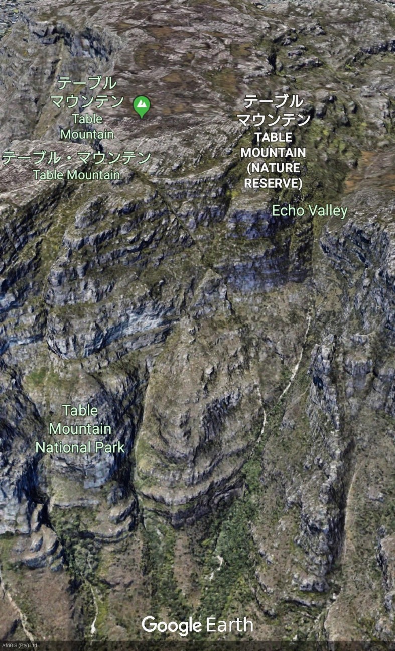
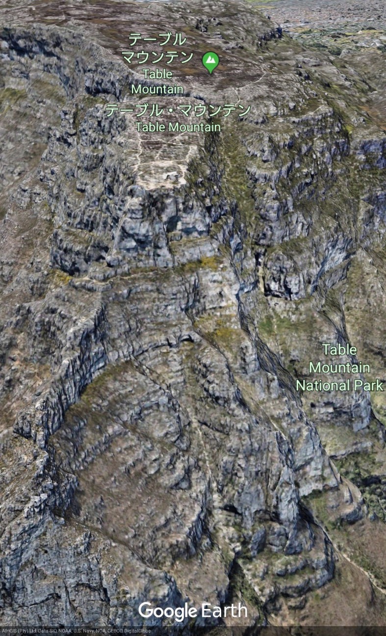
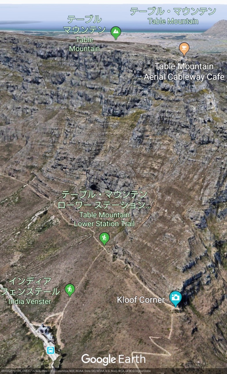
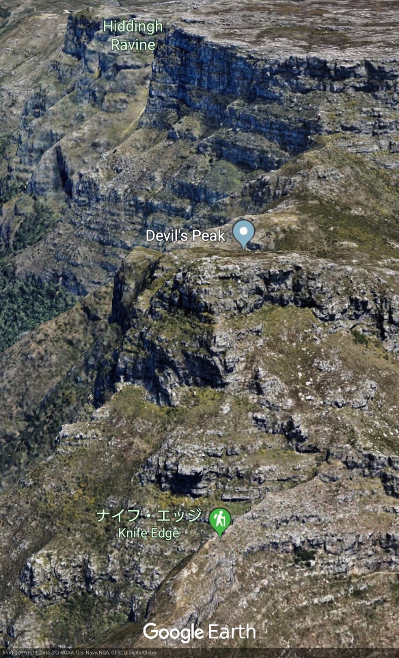
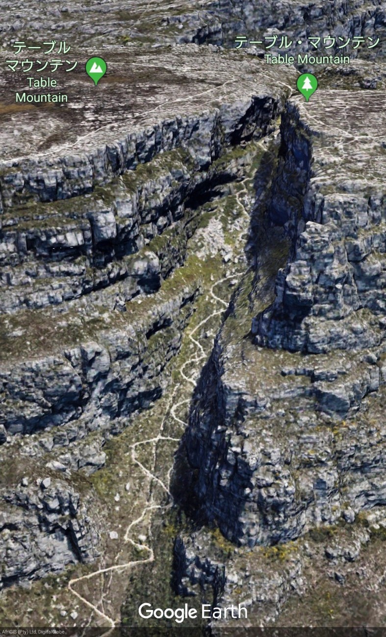
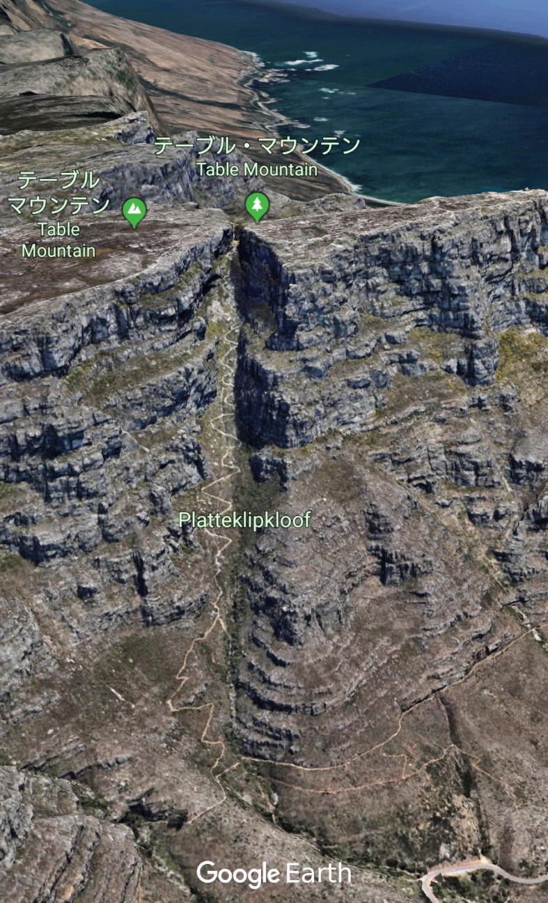
【Table Mountain】Google Earthで世界の山々を眺めてみよう。テーブルマウンテン(英語: Table Mountain、アフリカーンス語: Tafelberg)は、南アフリカ共和国西ケープ州のケープ半島北部にある標高1,086mの山。#googleearth https://t.co/R0VjQgUF72 pic.twitter.com/adLSRzcH9w
— Google Earth Photo Traveler@HITOJII (@findoutwonder) 2019年4月30日
LEARN ABOUT TABLE MOUNTAIN
Table Mountain (Khoekhoe: Huri ‡oaxa,mountain rising from the sea; Afrikaans: Tafelberg) is a flat-topped mountain forming a prominent landmark overlooking the city of Cape Town in South Africa. It is a significant tourist attraction, with many visitors using the cableway or hiking to the top. The mountain forms part of the Table Mountain National Park. Table Mountain is home to a large array of fauna and flora, most of which is endemic.
Hiking on Table Mountain is popular amongst locals and tourists, and a number of trails of varying difficulty are available. Because of the steep cliffs around the summit, direct ascents from the city side are limited. Platteklip Gorge, a prominent gorge up the centre of the main table, is a popular and straightforward direct ascent to the summit. Par for the course is about 2.5 hours but is done between 1–3 hours depending on one's fitness level. This route is very hot in summer, as it is located on the north facing slope of the mountain, with almost no shade along the 600 m climb from Tafelberg Road to the Table Mountain plateau.
Longer routes to the summit go via the Back Table, a lower area of Table Mountain to the south of the main, northern, plateau (which constitutes "Table Mountain" as seen from the Cape Town City Centre and Table Bay). From the Southern Suburbs side, the Nursery Ravine and Skeleton Gorge routes start at Kirstenbosch National Botanical Garden. The route via Skeleton Gorge to Maclear's Beacon is known as Smuts Track in memory of Jan Smuts, who was a keen hiker. The Bridle Path, or Jeep Track, makes a more gradual ascent from Constantia Nek along the road used to service the dams on Back Table. There are many other paths in popular walking areas on the lower slopes of the mountain accessed from Constantia Nek, Cecilia Park, Kirstenbosch, Newlands Forest and Rhodes Memorial.
On the Atlantic side, the most popular ascent is Kasteelspoort, a gorge overlooking Camps Bay, but there are a few others, but not as many as on the east side of the mountain.
There is a popular "Contour Path" that runs from Constantia Nek, and then, in succession, above Cecilia Park, Kirstenbosch Botanical Gardens, Newlands Forest, and from there, above Groote Schuur Estate, past the King's Blockhouse, at the north-east corner of Devil's Peak, immediately below the Mowbray Ridge cliffs, to the front of Devil's Peak and the north face of Table Mountain, ending at the bottom of Kloof Corner Ridge at the western end of the Table Mountain cliffs. It starts at Constantia Nek at 250 m, but immediately gradually climbs to around 320 m at Angela's Memorial and the look-out point above Cecilia Park. It then undulates down and up again at about this elevation as far the north-western corner of Kirstenbosch, when the path suddenly climbs quite steeply to 470 m to the scree (or Dassieklip) below the cliffs of Fernwood Buttress. It then descends again to 350 m, only to ascend again to 400 m, 1 km later. It remains at this level, as a true 'contour path', to the King's Blockhouse, and from there, eventually, to Tafelberg Road (at 400 m). From the King's Blockhouse it is possible to choose a footpath that will lead to the "upper contour path" which traverses the front (north face) of Devil's Peak and Table Mountain at 500 m, to just beyond the Lower Cable Station. From there it is possible, from either contour path, to join up with the "Pipe Track" which starts from Kloof Nek, and then runs at an elevation of about 300 m, below the cliffs of the Twelve Apostles, on the Atlantic side of the mountain range as far as the Oudekraal Ravine, where the path goes up the ravine to join the "Apostles Path" on top of the Back Table at an elevation of 685 m. There are innumerable paths which join the contour path from below (at least five from Kirstenbosch alone), and somewhat fewer that join it from above.
※日本語版のテーブルマウンテン (南アフリカ) - Wikipediaを読む。
(Source of Table Mountain is Wikipedia)
SHARE REVIEWS FROM GOOGLE MAP VOL.4
Kloof Corner
(TRANSLATED BY GOOGLE)
素晴らしいハイキングトレイル。登る必要があるいくつかの点がありますが、子供にとっても使いやすいように十分なサポートがあります。それはビジーではなく、その眺めは心を吹かれている。グループに参加し、ハイキングの日を作りましょう!
(ORIGINAL TEXT)
Awesome hiking trail. There is some points where one will have to climb, but there is enough support to make it user friendly even for children. It isn't to busy and the view is mind-blowing. Take a group and make a day out of the hike!
QUOTE SOURCE:Google マップ
(TRANSLATED BY GOOGLE)
息を呑むほどの景色を眺めながら、簡単に20分のハイキング。仕事後の飲みにも理想的です。
(ORIGINAL TEXT)
Easy 20 min hike with a breathtaking view. Even ideal for after work drinks.
QUOTE SOURCE:Google マップ
Maclear's Beacon
(TRANSLATED BY GOOGLE)
山の駅から、Maclearのビーコンヘの短いハイキングは素晴らしいです。テーブルマウンテンの最高点に達するには、約45分歩く必要があります。少数の訪問者がこのハイキングをいかにしたかは驚くべきことです。私たちは週末のためにここにいたが、ゴンドラに乗るために長い時間待たなければならなかったが、ほんの数人しか会わなかった。あなたは常にプラトーに沿って走るので、常に同じ高さにいます。日照にもかかわらず、それはかなり風が強かったので、あなたは暖かい服を必ず藩てください。
(ORIGINAL TEXT)
Von der Bergstation aus bietet sich eine kleine Wanderung zum Maclear's Beacon super an. Um zum höchsten Punkt des Tafelbergs zu kommen, muss man ungefähr 45 Minuten laufen. Es ist erstaunlich wie wenig Besucher diese Wanderung machen. Obwohl wir an einem Wochenende hier waren und sehr lange für die Gondelfahrt anstehen mussten, kamen uns nur wenige Menschen entgegen. Da man immer auf dem Plateau entlangläuft, ist man auch immer auf gleicher Höhe. Trotz Sonnenscheins war es recht windig und man sollte auf jeden Fall warme Klamotten mitnehmen.
QUOTE SOURCE:Google マップ
REFER TO THE SITE (URL) SHOWN BELOW

