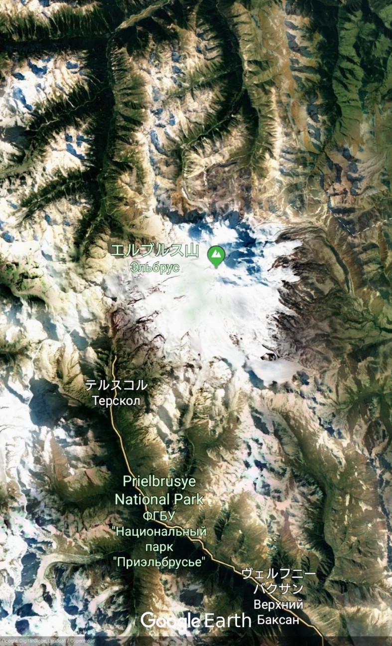
エルブルス山 / Mount Elbrus



SHARE REVIEWS FROM GOOGLE MAP VOL.1
Shturmovoy Lager' "Teplyy Stan"
(TRANSLATED BY GOOGLE)
Elbrus全体で最も暖かく居心地の良い攻撃キャンプ!食べ物、雰囲気、快適さとおもてなしは競争を超えています!ところで、価格は民主的なもの以上です!
(ORIGINAL TEXT)
Самый теплый и уютный штурмовой лагерь на всем Эльбрусе! Еда, атмосфера, комфорт и радушие вне конкуренции! И цены, кстати, более, чем демократичные!
QUOTE SOURCE:Google マップ
Elbrus 360 Mountain Hut
(TRANSLATED BY GOOGLE)
この小屋は、清潔で、乾いていて、暖かいです—北側で最高のものです。私はすぐにまたそこに滞在することを楽しみにしています!
(ORIGINAL TEXT)
This hut is clean, dry & warm - it’s the best one of the north side. I look forward to staying there again soon!
QUOTE SOURCE:Google マップ
シュトゥルモヴォイ・ラゲリ・ナ・セヴェルノム・スクロネ・エリブルサ
(TRANSLATED BY GOOGLE)
テントの下に十分なスペースがありますが、それを洗うことができます、ぼかし—金属製のスパチュラが傷つくことはありません。はい、そして人も。救助隊員の任務が変更されている緊急事態省の列車があります。次の日の天気予報をドアガラスにつないでください。トイレはなく、石の中の斜面の下にあります。それは非常に風が強く、多くの場所で石の壁があるからです。コミュニケーションは非常に安定した場所"メガフォン"とインターネット。山からの川の水。熱いシャワーでも避難所があります。しかし、この高度では、残っていない方が良いです、あなたは酸っぱくなり、回復は完了していません。
(ORIGINAL TEXT)
Достаточно мест под палатки, но бывает их подмывает, размывает – так что металлическая лопатка не помешает, на всякий случай. Да, и людно тоже бывает. Есть вагончики МЧС с меняющимися дежурными бригадами спасателей. Вешают прогноз погоды на ближайшие дни на стекло двери. Нет туалета- он под склоном среди камней. Бывает очень ветрено, потому на многих местах стенки из камней. Связь бывает довольно устойчивой местами "МегаФон" с интернетом. Вода в ручьях с горы. Есть приюты даже с горячим душем. Но на этой высоте лучше не задерживаться- закисаешь, восстановление не полное.
QUOTE SOURCE:Google マップ
Al'plager' "Severnyy Priyut"
(TRANSLATED BY GOOGLE)
美しい場所
(ORIGINAL TEXT)
Красивые места
QUOTE SOURCE:Google マップ
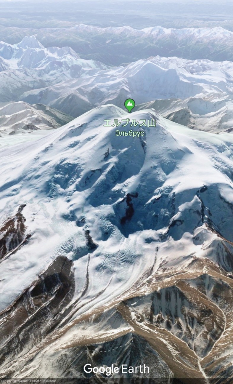

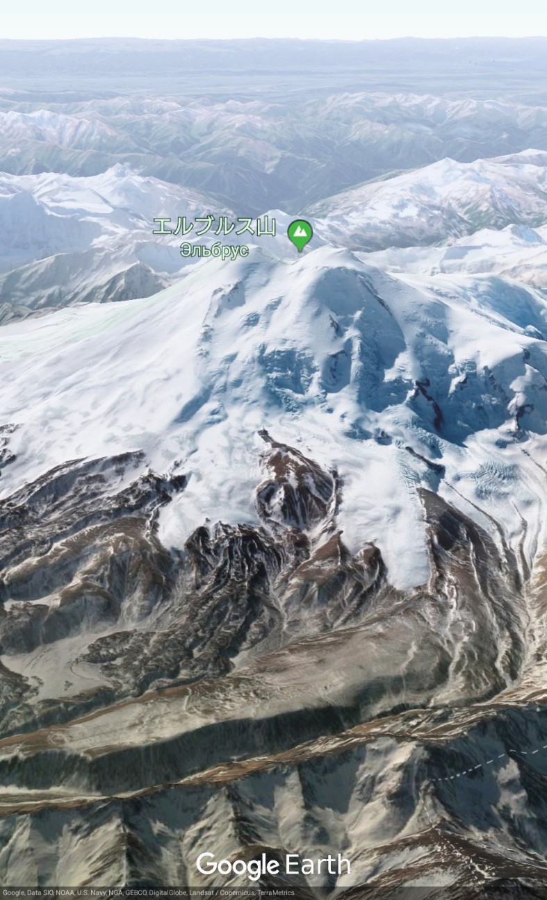
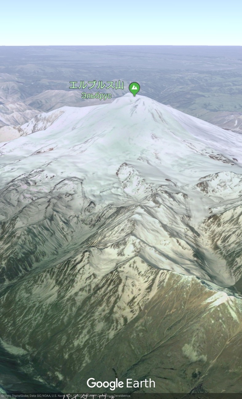
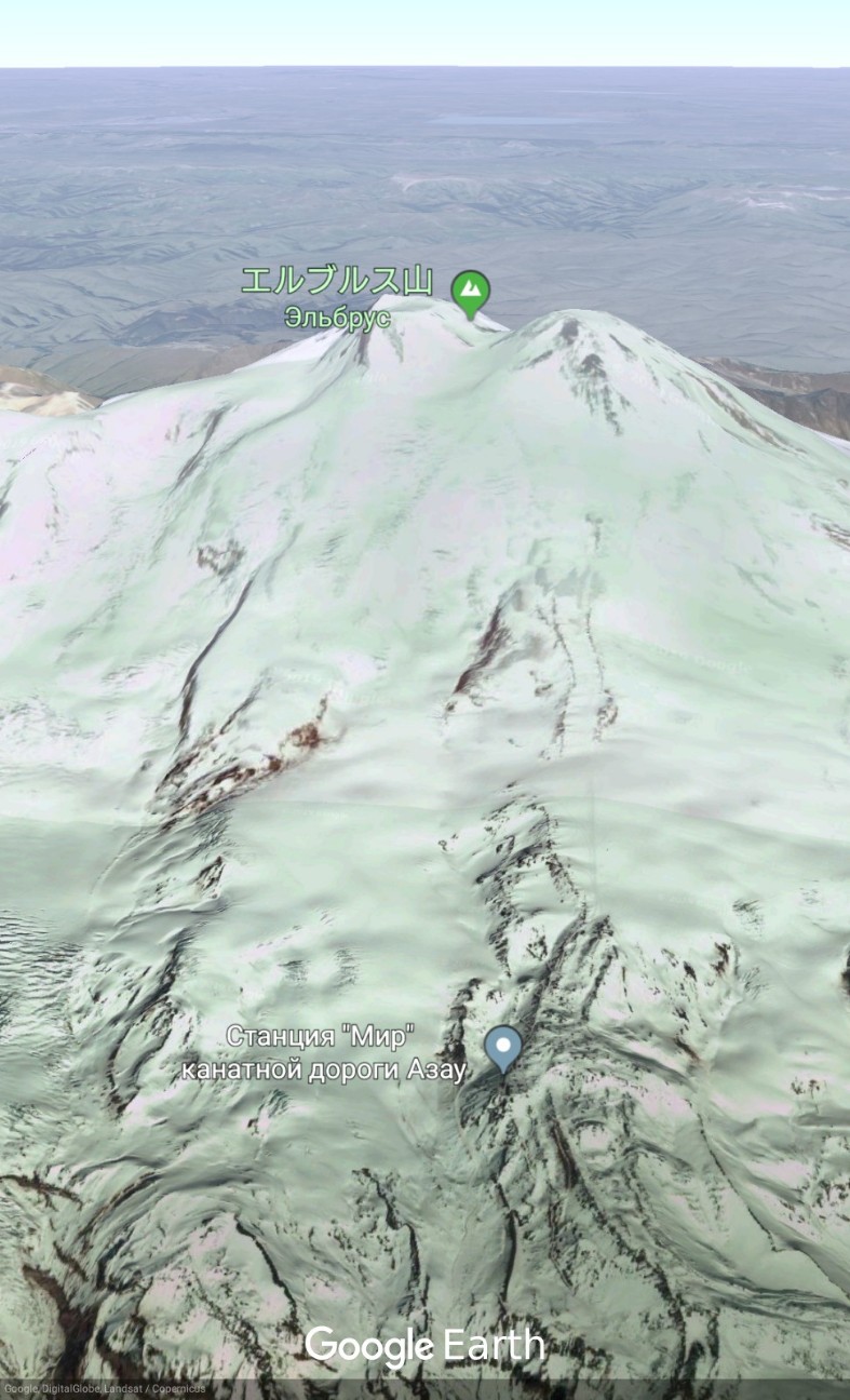

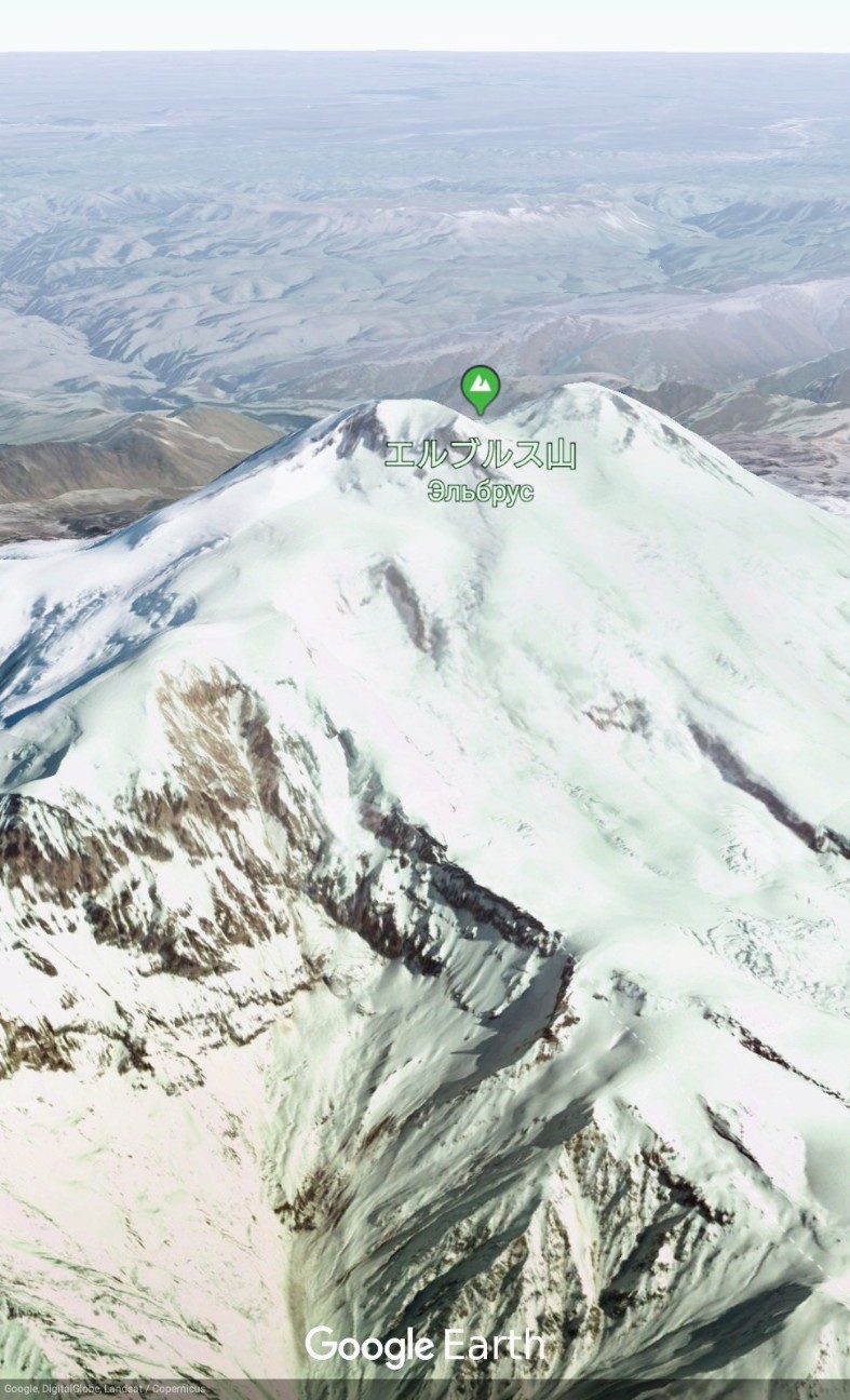
【Mount Elbrus】Google Earthで世界の山々を眺めてみよう。エルブルス山(ロシア語: Эльбрус)はコーカサス山脈の最高峰。標高5,642m。ヨーロッパの最高峰でもあるほか、ロシア連邦自体の最高峰でもある。#googleearth https://t.co/1RpbZQV4ln pic.twitter.com/xl6X4IpKH2
— Google Earth Photo Traveler@HITOJII (@findoutwonder) 2019年5月25日
LEARN ABOUT MOUNT ELBRUS
Mount Elbrus (Russian: Эльбру́с, tr. Elbrus, IPA: [ɪlʲˈbrus]; Karachay-Balkar: Минги тау, Miñi taw or Mın̨i taw IPA: [mɪˈŋːi taw]; Kabardian: Ӏуащхьэмахуэ, ’Wāśhamāxwa or Ꜧuas̨hemaxue, IPA: [ʔʷaːɕħamaːxʷa]; Adyghe: Ӏуащхьэмафэ, ’Wāśhamāfa or Ꜧuas̨hemafe, IPA: [ʔʷaːɕħamaːfa]; Hakuchi:Къӏуащхьэмафэ, Qʼuas̨hemafe, IPA: [qʷʼaːɕħamaːfa];) is a dormant volcano in the Caucasus Mountains in Southern Russia, near the border with Georgia. It could be considered the highest mountain in Europe, notwithstanding that the Caucasus mountains are at the intersection of Europe and Asia, and it is the tenth most prominent peak in the world.
Elbrus has two summits, both of which are dormant volcanic domes. The taller west summit is 5,642 metres (18,510 ft); the east summit is 5,621 metres (18,442 ft). The east summit was first ascended on 10 July 1829 (Julian calendar) by Khillar Khachirov, and the west summit in 1874 by a British expedition led by F. Crauford Grove and including Frederick Gardner, Horace Walker, and the Swiss guide Peter Knubel of St. Niklaus.
While authorities differ on how the Caucasus are distributed between Europe and Asia, most relevant modern authorities define the continental boundary as the Caucasus watershed, placing Elbrus in Europe due to its position on the north side of the watershed in Russia.
The Normal Route is the easiest, safest and fastest on account of the cable car and chairlift system which operates from about 9 a.m. till 3 p.m. Starting for the summit at about 2 a.m. from the Diesel Hut or Leaprus mountain hut should allow just enough time to get back down to the chairlift if movement is efficient. A longer ascent Kiukurtliu Route starts from below the cable-way Mir station and heads west over glacier slopes towards the Khotiutau pass.
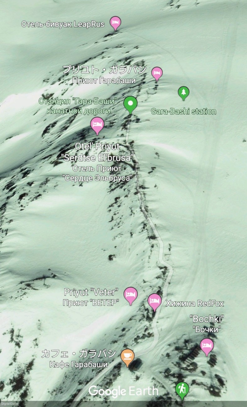
The ascent of Elbrus from the south takes about 6–9 hours, with a total height difference of 1,700–2,000 m (5,600–6,600 ft) between the Barrels Huts and the west summit of Elbrus. From Terskol village one can walk 5 km (3.1 mi) to the first elevation, Azau (2,350 m; 7,710 ft). A cable car service is available from Azau to the normal starting location for the Elbrus climb, known as Barrels Hut or Garabashi Station (3,720 m; 12,200 ft). The next destination – the Diesel Hut at 4,050 m (13,290 ft) – is located south from the Barrels Huts and up the slopes of Elbrus. From the Diesel Hut the route heads straight up towards the east summit of Elbrus, continuing south up the slopes. The slopes surrounding the classical route to Elbrus from the South contain large crevasses. Heading towards Pashtuhova Rocks (at 4,550–4,700 m (14,930–15,420 ft) elevation), the classical route up Elbrus becomes steeper after passing between two linear rock bands. After leaving this section, the Elbrus route heads on – first northward, to the east summit of Elbrus, or rather the saddle between the east and west summits of Elbrus (5,416 m; 17,769 ft), but soon turns left to the west summit (5,642 m; 18,510 ft). Before reaching this saddle, the route passes through a gently sloped basin filled with snow. At the saddle there is a shelter, from which the route heads west, then – left, in the direction of rocks forming the shoulder of the west summit, in the form of a narrow, exposed snow path that allows for a straight dash to the summit ridge.
The descent of Elbrus takes about 3–6 hours. While returning from the Elbrus summit, the most common mistake that climbers make and that often turns out fatal is heading low and down too early after their half-traverse below the saddle, especially under conditions of low visibility in stormy weather. On descent after the saddle, instead of going down the slope too early, one could stay high up on the slopes of the east peak, otherwise the route will become very steep and feature dangerous crevasses and falls.
The north climbing route requires more commitment and is more remote than the south route. Also contributing to this is the fact that on the lower altitudes of the mountain this route can offer less in the way of infrastructure. However, this also means less human intrusion onto the landscape. With mechanical support brought to minimum, the tour to Elbrus from the north is mainly camping, with the summit route being longer and harder, and requiring good teamwork and/or winter camping skills since, if the weather is favorable, it involves an interim camp at 4,800 m (15,700 ft) or gaining 2000 vertical meters/6561 vertical ft up and down. Elbrus ascent by the north route offers rich ice and snow experience under unpredictable weather conditions.
※日本語版のエルブルス山 - Wikipediaを読む。
(Source of Mount Elbrus is Wikipedia)
REFER TO THE SITE (URL) SHOWN BELOW
SHARE REVIEWS FROM GOOGLE MAP VOL.3
Отель-бивуак LeapRus
(TRANSLATED BY GOOGLE)
おそらく最高の、そして最も「豪華な」Elbrusの斜面に住んでいます。食べ物は本当においしいです、ベッドは快適であり、トイレはきれいです。あなたは本当に努力をしました、そしてそれは明白です。彼らは無線LANと電源を持っています。この場所はどんなバレル小屋や他の人たちと比較して超素晴らしいです。メンテナンスとジャンクの欠如のためにマイナスの1つ。これはロシアの流行です。彼らは自分たちの建物の周りを維持したり片付けたりしない。小屋がどのくらいの頻度で清掃されるのか私にはわかりませんが、とてもきれいに見えました。だから私はいくつかの清掃体制を持っていると思います。または私はそう願っています。
(ORIGINAL TEXT)
Probably the best and most "luxurious" living on the slopes of Elbrus. The food is really good, the beds are comfortable and the toilets are clean. Thy really made an effort and it is evident. They have wifi and power. This place is super nice compared to any barrel huts or others. One minus for the lack of maintenance and junk laying around. This is epidemic of Russia. They do not maintain or clean up around their buildings. I don't know how often the huts are cleaned, but they looked very clean. So I suppose the have some cleaning regime. Or I hope so.
QUOTE SOURCE:Google マップ
プリユト・ガラバシ
(TRANSLATED BY GOOGLE)
この避難所には説明できない美しさが開きます
(ORIGINAL TEXT)
Красота неописуемая открывается к этого приюта
QUOTE SOURCE:Google マップ
Otel' Priyut "Serdtse El'brusa"
(TRANSLATED BY GOOGLE)
Elbrusに泊まる最高の場所。他の企業では、トレーラーやテントで寝ていますが、ここでは8人が欲しかったのです。ホテルのオーナーは、滞在中に条件を改善しましたいくつかのトイレ、いくつかの洗面台を追加しました。食べ物は非常においしいですが、肉からはほとんど常に子羊ですが、エネルギーの積極的な浪費の状況では、すべてがうまく食べられました。レストランには良い家具とインテリアがあります。
(ORIGINAL TEXT)
Лучшее место для ночлега на Эльбрусе. В других компаниях спишь в вагончиках или палатках, а здесь хотел по 8 человек в комнате. Хозяева отеля улучшили условия во время нашего нахождения - добавили несколько туалетов, несколько умывальников. Еда в ресторане очень вкусная, хотя из мяса почти всегда баранина, но в условиях активной траты энергии все хорошо съедалось. В ресторане хорошая мебель и интерьер.
QUOTE SOURCE:Google マップ
"Bochki"
(TRANSLATED BY GOOGLE)
ガスの入ったキッチンがあります。水はありません、私たちは雪を溺れる必要がありますが、それはまるで汚いです。バレルにはヒーターと電気のあるソケットがあります。順化のためには、私の意見では、無意味な場所、私たちはより高くなる必要があります。
(ORIGINAL TEXT)
Есть кухня с газом. Воды нет, надо топить снег, а он кругом грязный. В бочке есть обогреватель и розетки с электричеством. Для акклиматизации, по моему мнению, бессмысленное место, надо идти выше.
QUOTE SOURCE:Google マップ
カフェ・ガラバシ
(TRANSLATED BY GOOGLE)
3700メートルの唯一のカフエ&レストランです。ウズベキスタンは家族経営です。あなたはトルコ語を扱うことができます。ウズベキスタンのピラフとサハラの卵はとても素敵です。私たちはテントにいたので、この最初のキャンプではなかったので、毎日このカフェで朝食と食事を食べ、熱水でお湯を買いました。その後、5642ビールを飲むのが最も楽しいです。
(ORIGINAL TEXT)
3700 metredeki tek kafe ve restaurant.. Özbek bir aile işletiyor.. Türkçe anlaşabiyorsunuz.. Özbek pilavını ve sahanda yumurtayı çok güzel yapıyorlar. Biz bu birinci kampta varillerde değil çadırımızda kaldığımızdan , her gün bu cafede kahvaltı ve yemek yedik , termosumuzla sıcak su da satın aldık.. Zirveden sonra burada 5642 bira içmek en keyiflisi..
QUOTE SOURCE:Google マップ
(TRANSLATED BY GOOGLE)
高所にある優れたカフェホテル。固定電気があります。光はいつもそこにある。あなたは電話を充電することができます、それは非常においしいと手頃な価格です。あなたは天気を待つことができますか、または主要な白人の尾根の美しい景色でお茶を飲むことができます。必要に応じて、安価な料金で快適な客室で夜を過ごすことができます。
(ORIGINAL TEXT)
Отличное кафе-гостиница на большой высоте. Здесь есть стационарное электричество. Свет есть всегда. Можно зарядить телефон, очень вкусно и доступно покушать. Можно переждать непогоду или просто попить чая с красивейшим видом на главный кавказский хребет. При желании можно переночевать в комфортных номерах за небольшую цену.
QUOTE SOURCE:Google マップ

